How can socio-spatial fragmentation be measured and analyzed over 50 years, connecting it to public policies and impacts on the landscape?
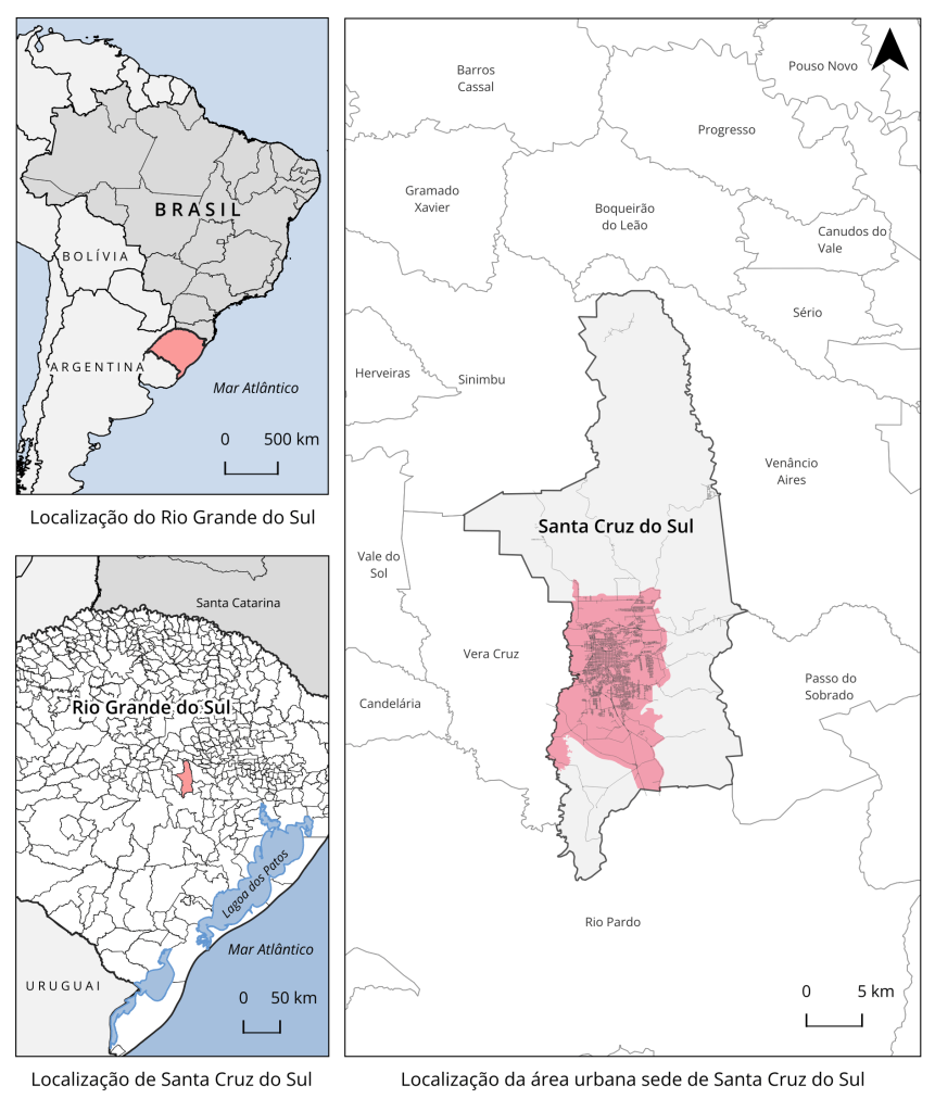
Doctoral research independently conducted, using the medium-sized city of Santa Cruz do Sul as a case study – located in Rio Grande do Sul, Brazil.
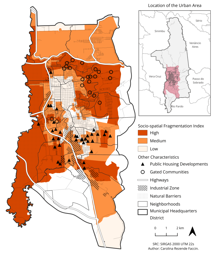
Methodology: I developed a quantitative and qualitative methodology that combined historical analysis with spatial data analysis. Utilizing Python and QGIS, I collected, organized, and analyzed data, creating four types of indicators (environmental, social, housing, infrastructural) to map the evolution of socio-spatial fragmentation from 1970 to 2022.
Conclusion: The analysis revealed the formation of physical and symbolic barriers that accentuate segregation, with a sharp distinction between the north and south of the city. While the north concentrates high-income gated communities, the south concentrates low-income popular housing developments.
Contributions: The study demonstrated how public policies and market dynamics can reproduce patterns of exclusion, providing a diagnosis that serves as a subsidy for formulating urban policies.
Data Sources: Interviews, Public Policies, IBGE, Municipal City Hall Database, IBGE, MapBiomas, OpenBuildings, OpenStreetMap, FEPAM/RS, DAER, among others.
Tools: Python, QGIS, PostgreSQL/PostGIS.
Other Publications:
- Faccin (2025) (pt/br): Paper submitted to the seminar XXI Enanpur.