Following the 2024 floods, how could we, as a scientific community, provide urgent technical diagnoses and recommendations to support the recovery of small municipalities in inland Rio Grande do Sul?
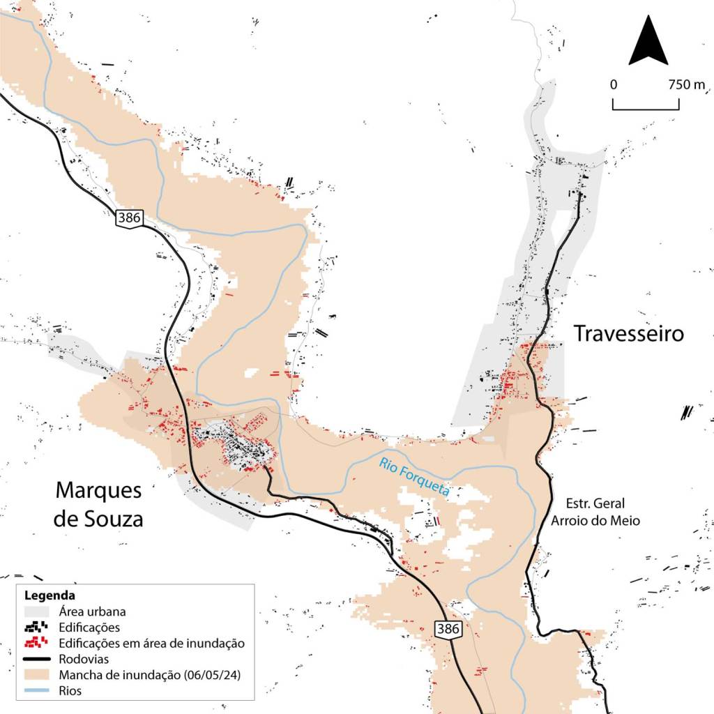
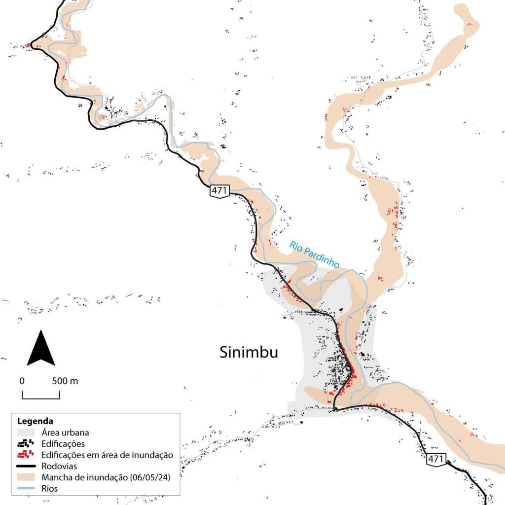
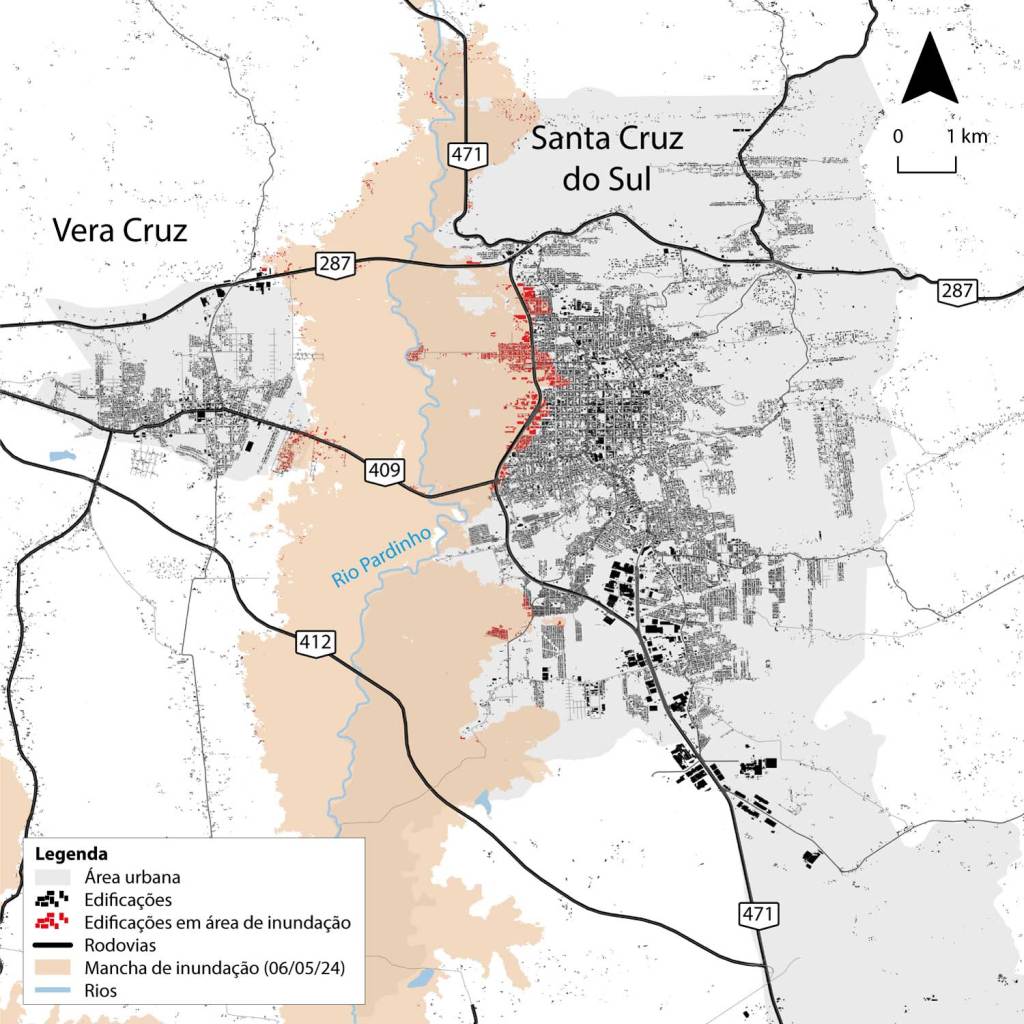
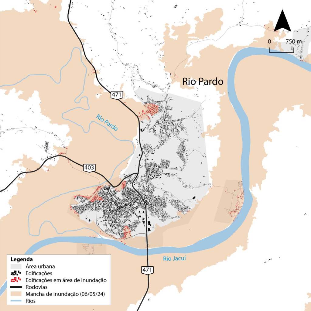
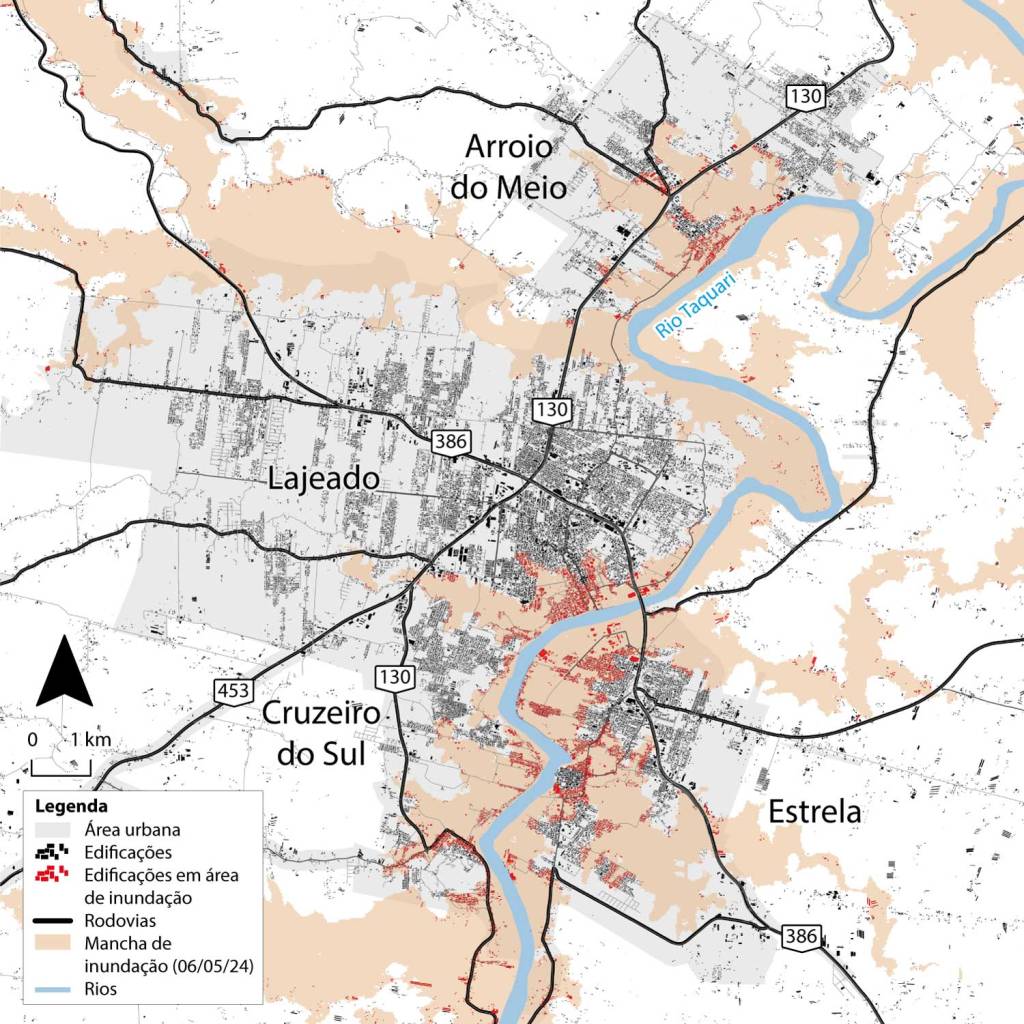
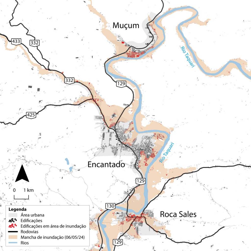
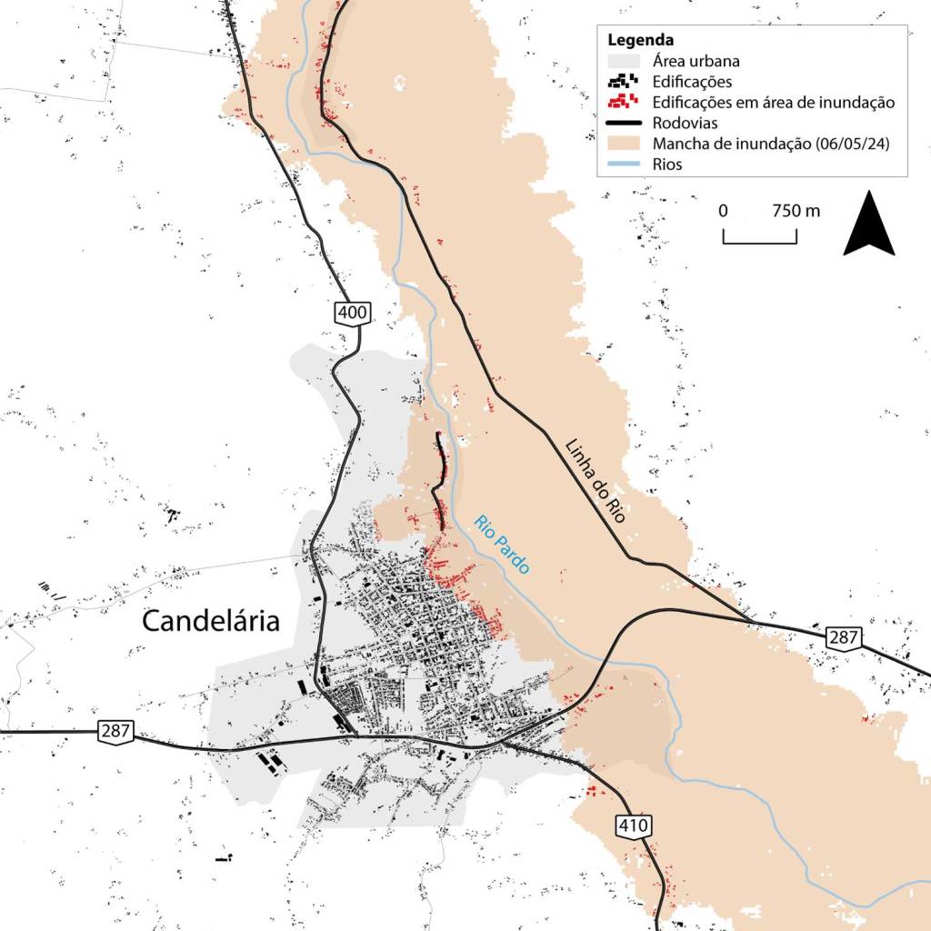
I joined a voluntary task force of researchers to analyze existing planning instruments. I co-authored the technical report, responsible for the geospatial analysis that identified the urban areas most vulnerable to flooding.
We produced a technical report with scientific analyses and recommendations that was delivered directly to public managers (via COREDE Vale do Rio Pardo) to support emergency decision-making and adaptation to climate change.
Data Sources: IBGE, Open Buildings, OpenStreetMap, IPH/UFRGS.
Tools: QGIS and Documentary Analysis of Public Policies.