How can we define guidelines for priority occupation of municipalities after the 2024 floods — in a safe, fast, and low-budget manner?
Case Study: Seven municipalities in Taquari Valley Region, in Rio Grande do Sul – Brazil.
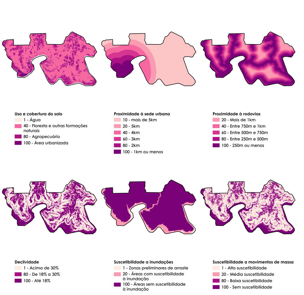
Methodology: Application of a multicriteria analysis that involved modeling, normalization, and weighting of factors (slope, flood risk, landslides, and infrastructure) to identify a map with four levels of urban suitability, considering climate change.
Results: Classification of safe areas suitable for urban expansion, serving as an immediate and emergency technical support tool.
Data Sources: FEPAM/RS, MapBiomas, DAER, OpenStreetMap, IPH/UFRGS.
Tools: QGIS, Python, and Multicriteria Analysis.


Reports Developed
Reports delivered to SEDUR (Secretariat of Urban and Metropolitan Development of Rio Grande do Sul), in portuguese.
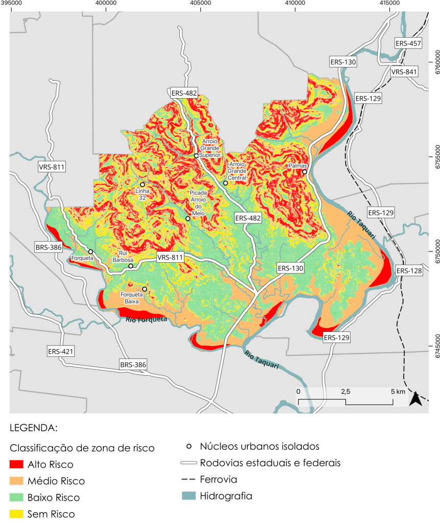
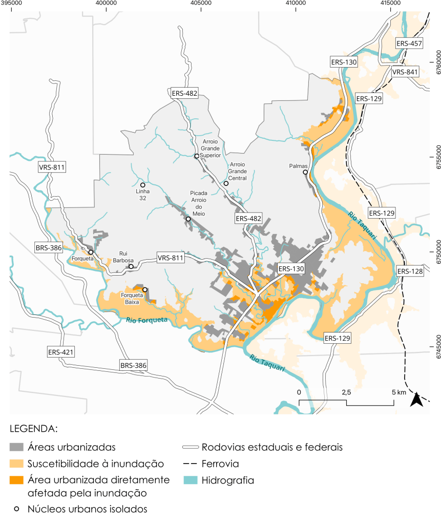
1. Risk Zoning
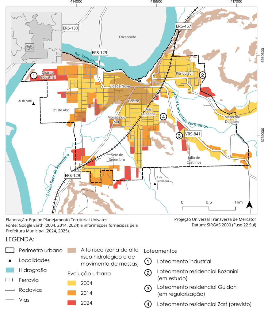
Example: Maps of the municipality of Arroio do Meio

2. Preliminary Guidelines for Priority Occupation
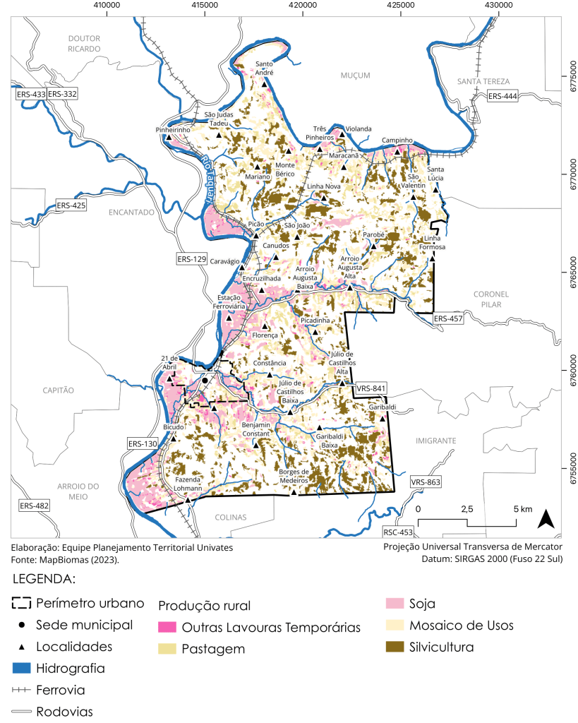
Example: Maps of the municipality of Muçum


3. Diagnosis and Technical Reading
Example: Maps of the municipality of Roca Sales